Hyderabad, Reimagining Urban Safety: Drones Take Over Civil Inspections
Jun 23, 2025
VMPL
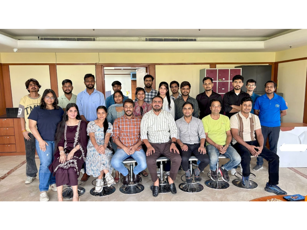
New Delhi [India], June 23: In a major leap towards modernizing infrastructure management, a pioneering drone-based inspection system is being introduced as a transformative solution for urban and structural assessments. This UAV-powered framework, developed under the Civil Inspection Project led by Prof. Harikumar Kandath, Assistant Professor at the Robotics Research Center, IIIT Hyderabad, in collaboration with IHub-Data, offers a faster, safer, and more efficient alternative to conventional manual surveys.
Prof. Kandath, who joined IIIT Hyderabad in 2020 after completing his Ph.D. at IISc Bangalore and postdoctoral research at NTU Singapore, specializes in aerial robotics, multi-robot systems, and control theory. His expertise in UAV autonomy, robust estimation, and fault detection forms the foundation of this inspection framework--aligning research depth with real-world applications in infrastructure monitoring.
The project also benefits from key contributions by:
- Prof. Ravi Kiran S, who developed the computer vision algorithms that drive several of the system's core modules.
- Prof. R. Pradeep Kumar, who provided expert insights into structural parameters, ensuring that the system's evaluations align with real-world civil engineering principles.
While traditional building inspections often involve physical risk, extensive manpower, and significant time investments, this new drone-integrated system streamlines the entire process--from aerial data capture to intelligent analysis. By leveraging high-resolution UAV imagery combined with automated computer vision algorithms, the project aims to redefine how cities monitor structural health, spatial compliance, and architectural features.
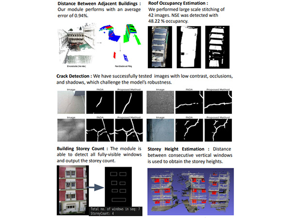
At the heart of this innovation lies a suite of seven intelligent modules, each engineered to address a specific aspect of structural evaluation. One of the most critical among them, the Distance Module, accurately measures the gap between adjacent buildings, ensuring adherence to urban planning norms and building safety regulations. This is especially useful in densely populated areas where unauthorized constructions can pose serious risks.
Further enhancing structural assessment is the Plan Shape and Roof Area Estimation module, which calculates the geometry of a building's footprint and roof surface. This data becomes invaluable for load-bearing evaluations and assessing solar panel installation feasibility. Complementing this, the Roof Layout Estimation module provides insights into roof slopes, ridgelines, and segments, important for gauging water drainage patterns and structural soundness.
Structural safety is also prioritized through the Crack Detection and Building Tilt Estimation modules. Using advanced image processing, the system can detect surface-level cracks at an early stage, enabling preemptive maintenance before major failures occur. The tilt module, meanwhile, assesses the angular deviation or lean of a structure, vital for identifying foundational instability or seismic vulnerability.
Understanding a building's capacity and urban relevance is made easier with the Window Detection and Storey Count module. By analyzing visual data to identify windows and floor lines, it estimates the total number of floors, aiding occupancy estimates, fire safety planning, and facade analysis. In parallel, the Storey Height Estimation module calculates the average vertical height per floor, which is crucial for evacuation planning and digital urban modeling.
This integrated system isn't just a toolkit of algorithms, it's a complete UAV-based pipeline, beginning with drone-assisted image capture and culminating in automated structural insights. This end-to-end approach allows for large-scale deployments with minimal manual intervention. A user-friendly graphical interface (GUI) is currently under development, which will soon enable engineers, architects, and city planners to interact with visual analytics and reports in real-time.
The project has already begun demonstrating its practical benefits in urban pilot studies, particularly in areas requiring periodic compliance checks and pre-construction validations. With India's cities expanding rapidly, such smart surveillance tools could play a pivotal role in creating more resilient, efficient, and data-driven urban ecosystems.
For detailed technical documentation and module breakdowns, visit:
https://civil-inspection-project-docs.readthedocs.io/en/latest/modules.html
(ADVERTORIAL DISCLAIMER: The above press release has been provided by VMPL. ANI will not be responsible in any way for the content of the same)